Executive summary
- Ireland needs dense neighbourhoods with matching infrastructure
- Our existing planning tools don’t deliver them
- The problem is one of coordination: building neighbourhoods is complex and involves many stakeholders
- Land readjustment is a tool for coordinating local governments, infrastructure providers and landowners in service of creating new neighbourhoods
- Landowners pool their land, giving up some for infrastructure, in exchange for a re-drawn, higher value plot
- Better infrastructure and more permissive planning incentivises fragmented landowners to sign onto one plan
- Land value capture incentivises local authorities to allow intensive development
- Infrastructure is funded by land sales
The dream of City Edge
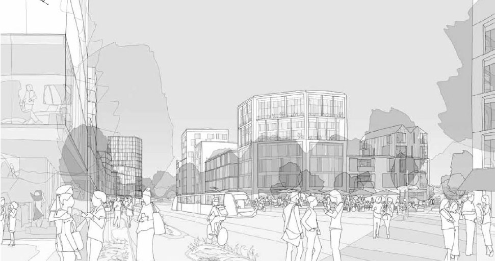
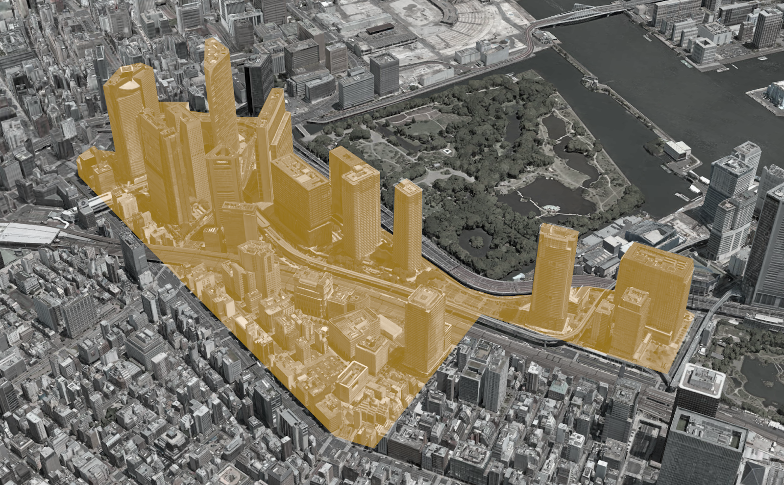
The dream of Irish housing policy looks something like the City Edge scheme on the Naas Road in west Dublin. City Edge is a plan to turn 700 acres of mostly industrial land into a beautiful, liveable, functional, walkable home for 80,000 people, with employment for a further 70,000.
The ambitious City Edge masterplan is inspired by the best of modern urbanism. It references successful new urban districts in Copenhagen, Vienna, Amsterdam, and Paris. It’s built around the principles of transit oriented development, in which neighbourhoods are designed around a spine of high-capacity public transport. The density allows lots of homes per hectare, nice walkable neighbourhoods, and a lighter environmental footprint than traditional greenfield development.
There is, however, a problem. City Edge was signed off by South Dublin County Council and launched, to great fanfare, in 2022. Three years later, little has happened. In a city awash with money, and sorely lacking housing, why is City Edge stuck?
A big challenge in the City Edge plan is the existing landowners. The site is currently home to about 1,500 businesses. Many of them own the land on which they operate. It’s been clear from the early days of the scheme, in its Strategic Framework, that assembling land for the scheme will be difficult.
Ireland is stuck. It needs big, ambitious schemes like City Edge if it’s to address unmet housing demand. It needs huge new neighbourhoods with the infrastructure to match. Given the scale of housing shortages, piecemeal solutions won’t cut it.
However, ambitious housing schemes are, by their nature, complex. They are big. They involve lots of landowners. They require local authority buy-in. Infrastructure-delivering agencies need to provide water pipes and other utilities. Getting all these groups to align on one plan is not easy.
Many countries make use of a specially designed legal mechanism to build complex schemes like City Edge. Ireland has never used it, and it would require new legislation.
It’s called land readjustment. It has a long track record in Germany, Japan, and Spain. It was used to develop a full 30 per cent of Japan’s urban area. Let’s discuss why it’s necessary.
The problem: big schemes have more stakeholders
There are dozens of well-located Irish greenfield and brownfield areas, near lots of jobs. But due to inadequate infrastructure, restrictive planning rules, or fragmented ownership, they aren’t viable as projects. They don’t even make it as far as City Edge. Places like Cork’s docklands, or greenfield land along the Dublin to Cork rail line, just west of Adamstown. One could name a dozen more.
To build a large, intensive scheme, there are three ingredients: a single big site (e.g. between 5 and 40 ha.), infrastructure, and planning approval. Land readjustment helps bring all three ingredients together.
First up is the land. If you don’t already own the area in question, you need existing landowners to sell. The bigger the project, the more landowners who need to be convinced. Getting multiple landowners to agree on a scheme is incredibly challenging. If even one landowner isn’t willing to participate, a scheme can’t go ahead.
For example, the following picture shows finely plotted lands that surround Rush train station. It’s fragmented into many different plots of varying sizes and shapes. Their owners would have to work together in order to fully realise the area’s potential as a new neighbourhood.
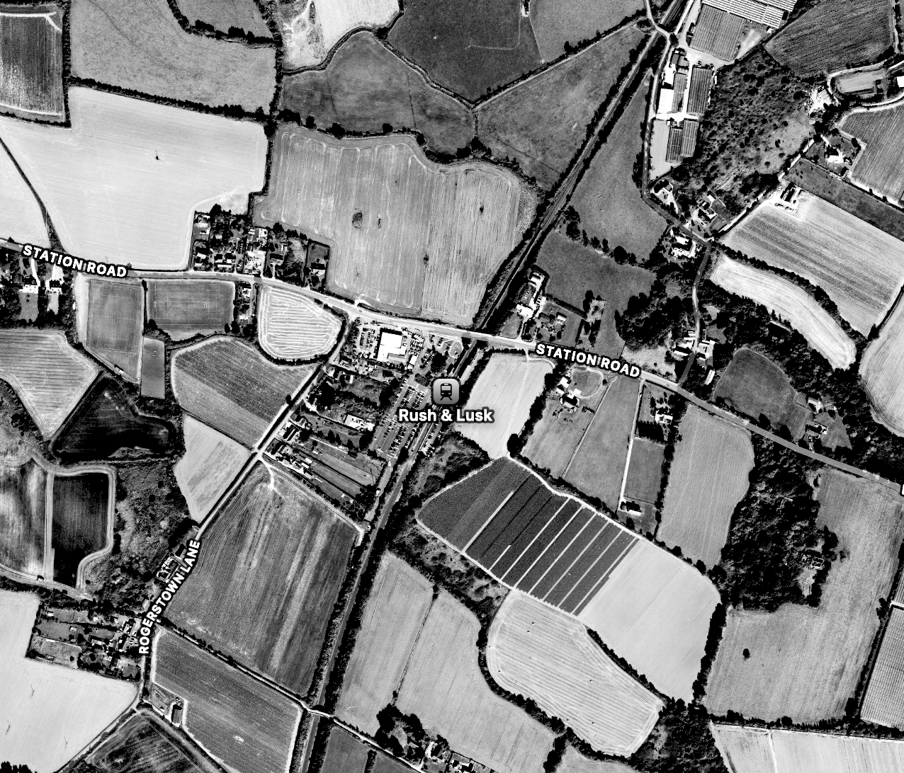
Rush already has some good infrastructure in place. Its DART station could support much more intensive use of the land. But to do this most efficiently, the land would need to be combined into a big site, and a new road layout would be needed. Public parks and other amenities would enable denser development by making it more liveable and attractive.
The last ingredient of a big scheme is planning approval. As we’ll see below, our current planning system needs an extra tool to make schemes like this really come together.
The tools we have now
Our current system offers two ways for the government, developer, or AHB who is seeking to develop an area of fragmented plots to address these problems. But they don’t work at scale.
First, agencies can try to persuade the landowners to sell. However, as we’ve just discussed, refusals to sell can potentially jeopardise the entire project.
If persuasion fails, there is another option. Irish law allows the government to acquire land in cases where doing so serves the public good, such as for essential infrastructure, in exchange for some compensation. This process is known as a compulsory purchase order (CPO).
However, CPO is a blunt tool. It’s slow and expensive from the perspective of whoever is assembling the land. It’s also legally fraught and controversial. Ultimately, it’s a very limited tool, only to be used as a last resort.
Local authorities do have some ability to encourage large developments. Development Plans, for example, are how local authorities set out the development they want to see across their given area. Local Area Plans do the same for smaller areas.
Urban Development Zones (UDZs), a new tool, are a step in the right direction for the planning system. They create detailed plans for specific areas, which helps cut down on the uncertainty of the planning permission process. However, UDZs don’t incentivise landowners to pool and reassemble land. Even after identifying, masterplanning and getting consent for a UDZ, a scheme is likely to struggle if land ownership remains fragmented.
Ireland’s planning system still lacks a tool to overcome the problem of fragmented ownership. This is where land readjustment comes in.
Land readjustment: an outline
Let’s recap the discussion so far. Coordination problems between landowners, infrastructure providers, and planners make it hard to build big, complex schemes. Our current tools are inadequate to the problem. Landowners are left with no real incentive to work together, even when that would allow more valuable land parcels and infrastructure to be created. The costs and benefits of that development don’t fall evenly across all landowners, so they’re reluctant to proceed.
Land readjustment is a tool to solve this coordination problem.
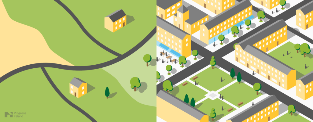
At its core, land readjustment involves pooling the land in a given area, replotting it into a new development that has higher density and better infrastructure, and giving the original landowners a plot of land in the new development.
This changes the incentives of landowners. Instead of getting a fixed cash amount reflecting the current value of the property, as compulsory purchase orders provide, land readjustment provides financial upside.
Landowners can expect to make money because their new plot is worth more than the old one. It will be smaller than their old plot because some land has been given to the public, but its new value is higher because of the replotting and replanning. These landowners now have a huge incentive to say yes to development. More broadly, the scheme aligns the incentives of all participants, from landowners to the local authority to utility providers.
Here’s an overview of how it works. A more detailed proposed process can be found later in this paper.
On a suitable site – with high demand for land, inadequate infrastructure, and fragmented ownership – a new scheme is drawn up. The land is replotted to make it more suitable for intensive development. Roads, parks, and public transport are added alongside more intensive development of the sites. The preexisting land parcels are reorganised around the new infrastructure and reapportioned pro-rata to the original landowners.
The new scheme now has more infrastructure, and land ownership is aligned with the new infrastructure. The next element is planning. Planning rules are re-drafted to align with the new scheme. The basic point here is that the land is now permitted to be used more intensively than before, and planning risk is removed.
The original landowners receive a plot of land in this revamped area. It’s smaller than their old plot because some land has been given to the public, but its new value is higher because of the replotting and replanning. These landowners now have an incentive to say yes to development.
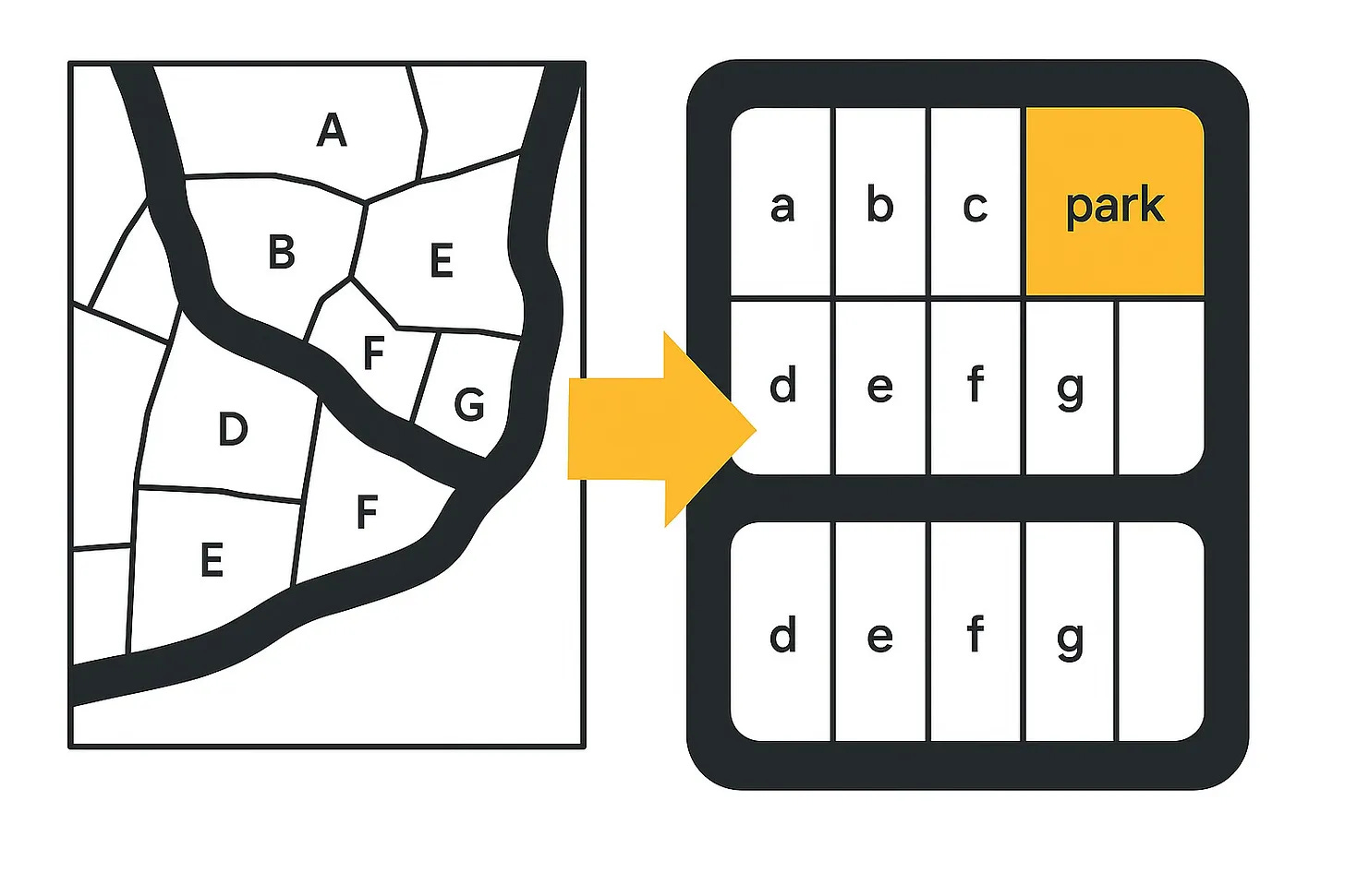
To make this more concrete, consider the stylised diagram below. On the left, landowner A has an uneven plot of land among other uneven plots. His development prospects are limited. But moving to the right hand diagram, plot (a) is well serviced by infrastructure and ready for new development. He has every reason to want to get to that point, as do his neighbours.
Next, the scheme is put to a ballot. If a supermajority of landowners are in favour, the scheme may go ahead. Should the supermajority threshold be passed, all land is included in the scheme. Original parcels of land are swapped for land of proportional value in the new scheme. Landowners would expect to profit materially from the deal, or at the very least get a plot of equal value. The profit comes from new, more intensive planning guidance and new infrastructure.
Land readjustment aligns stakeholders’ incentives towards cooperating to create an intensive scheme. For land owners, new infrastructure and an increase in density pushes up land values. This is their carrot. The stick is compulsory participation in the scheme, should the ballot pass. Landowners are assured that funding generated from sales of land are ring-fenced and used solely for the improvement on infrastructure on the site.
Local authorities receive a high quality masterplanned neighbourhood, whose infrastructure is fully funded. Infrastructure providers are fully funded and can invest ahead of demand.
The principles of land readjustment
Land readjustment has a long track record around the world. In Japan, 30 per cent of the built-up environment has been created or redeveloped by land readjustment. Almost 10,000 projects were completed between 1954 and 2013. South Korea has 397 land readjustment projects to develop 43,580 ha. over five decades. One Seoul project created a 13,000-fold land value uplift over 26 years. Germany has used land extensively (Umlegung) since the early 20th century. In one state, Baden-Württemberg, 84 per cent of the building plots were developed by land readjustment in the 1980s.
This paper examines international case studies in greater detail in its appendix. Each country’s precise mechanism is slightly different, but there are basic principles shared by all successful land readjustment regimes.
Majority support is essential for land readjustment. If landowners don’t want the process to go ahead, they will naturally oppose it using all legal and political means available. If that happens, then any actor redeveloping the area would be forced to use compulsory purchase orders at a large scale. That would be incredibly time consuming and expensive. For this reason, it makes sense to include a ballot of landowners at an early stage in the process. A supermajority must endorse the plan before it can proceed.
Tasking a specific company with carrying out land readjustment is also important. This company handles tasks such as negotiating with landowners, designing the new neighbourhood, and arranging the provision of utilities. Without such a company, this task would be left to landowners. This is an insurmountable level of hassle and expense.
Replotting or the drawing of land boundaries. As we discussed earlier, land is best laid out in grid structures within urban areas. This conflicts with the layout of many green- and brownfield sites in Ireland. Replotting land parcels into this grid structure means that the original owners won’t own the exact same parcel as before. Some land has to be used for public infrastructure.
Value capture and distribution is also essential to land readjustment’s success. The “value” comes from the economic activity generated by the new land use patterns, and is reflected in the price of the land in the area.
This value is key to the incentives of each participant in the process. First, the landowners don’t want to give up land for free, but want to end up better off. The profit they make should be in proportion to the cost each owner has to internalise as part of the process (though perfect fairness may be unachievable). Semi-state agencies or private firms will have to build the infrastructure so that plots are serviced. The local authority will be involved in replanning the area as well as with infrastructure like parks and roads. Land readjustment creates a lot of value, but it has to be properly distributed among these actors to ensure that everyone has a reason to make it work.
Finally the compulsory aspect of land readjustment is crucial if the policy is to have any teeth. This is the other side of the majority endorsement mentioned above. If a supermajority of landowners are in favour of a plan, the small minority who oppose it shouldn’t be allowed to block it. This minority should be given every opportunity to participate in the scheme. They could be offered alternative compensation methods like cash and development company equity. Ultimately, however, they cannot block it indefinitely.
This raises a legal question. Normally, only compulsory purchase orders can be used to forcibly transfer ownership of land, and they are subject to strict legal tests. Legislation creating land readjustment in Ireland, as in Japan and Germany, must contain a robust and legally defensible mechanism to enable this. Additionally, in order to protect the constitutional property rights of participating landowners, fair and impartial property valuations should be used to create a floor on the compensation received in exchange for land.
A process for Ireland
What follows is a draft of how land readjustment might work in Ireland. Designing a policy invariably involves some assumptions, which have been highlighted in the following plan.
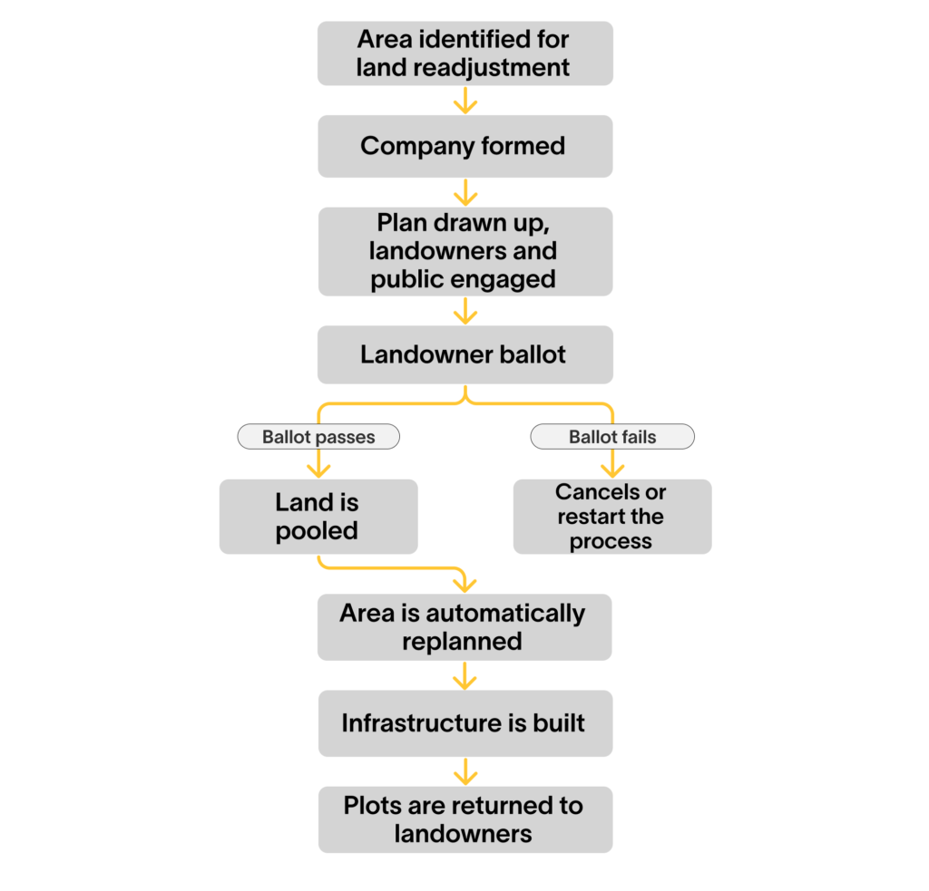
Identify the land
To begin, land with development potential is identified by the local authority. The land could be greenfield or brownfield. Even if the land has not been identified in the Development Plan, it should be reconcilable with overall plans for the area.
If the area is within an Urban Development Zone (UDZ), the plan will become part of the UDZ’s Development Scheme. If the area is not within a UDZ, the plan will be appended to the local authority’s overall Development Plan.
Once suitable land is identified, it is designated as a ‘candidate land readjustment area’ by the relevant local authority.
Form the company
Before the company is formed, engagement with landowner by the local authority should be used to gauge interest in a land readjustment process. Without significant interest from landowners, creating the company won’t be worthwhile.
If there is landowner interest at this stage, company formation can take place. This new company is necessary for two reasons. First, it can have a project-specific mandate and be financially ringfenced. Second, it can have robust governance.
The local authority is one potential project promoter, but not the only one. If the local authority is unwilling to lead the project, it could award the job to a private firm such as a developer, or local landowner, via a tender process.
The company will require financing. There is more than one way to do so. The simplest is for the company to retain ownership of specific land parcels and sell them once the construction phase is over. (This would require bridge financing either from the government or the private sector.) Alternatively, the company could sell a minority equity stake. This equity could later be exchanged for some finished plots. Lastly, the company could receive a grant from either the local authority or the national government.
To ensure the involvement of relevant stakeholders, company board seats could be reserved for relevant state agencies and some landowners.1
Make the plan
The company’s first task is to draw up a plan for the area. This plan will give detail of how different pieces of land will be used, and the kinds of plots that landowners will receive if the plan goes ahead.
The upshot of this process will be a plan a) with more intensive land use and b) without planning risk for individual sites. In this way, the plan will be like a UDZ Development Scheme. The plan will generate specific instructions regarding heights, widths, floor to area ratios, etc, of all plots. This specificity will give landowners comfort that the finished scheme won’t be sunk by an adverse planning decision.
In order to get UDZ-like certainty, an extensive process of up-front consultations and surveys must be undertaken. The scheme will invest in relevant environmental surveys such as Environmental Impact Assessments or Appropriate Assessments. The cost of these surveys will be borne by the company up front, which will recoup its cost later through sales of land. The scheme will also invite public feedback through a consultation process. The plan will only take force after it has received approval from planning authorities and has passed a ballot of landowners (more on the ballot later).
Environmental surveys, public consultations and masterplanning are costly. The development company will continually consult with landowners to ensure it has their support before investing in each of these steps.
The core job of the development company, then, is to win and keep the support of landowners and attain permission for more intensive use of land with a high degree of certainty. It does this by ongoing engagement with landowners, public consultations, and engagement with the planning process including managing relevant environmental impacts.
In the final scheme, each landowner will get a slice of land of at least equivalent value to what they put in. Their land will be independently valued at the outset of the scheme. An independent valuer will help ensure each landowner is not made worse off in the post-plan layout.
To protect against the failure of a scheme, a generous “margin of safety” should be targeted at the planning stage. Local government could choose to underwrite any potential losses to landowners.
State agencies like TII, Uisce Éireann, and ESB will also be consulted in depth on how to get the land fully serviced with infrastructure at the construction stage.
Landowners have the final say over this plan at the ballot stage, so the company is well incentivised to engage them heavily to maximise the chances of approval.
Ballot the landowners
A final proposal for the area is drafted and presented to landowners for a vote, requiring a supermajority of owners (e.g. 70 per cent) owning a supermajority of the land in question (e.g. 70 per cent) to pass.
Without both of these provisions, adverse outcomes are possible. For example, if only a landowner vote was required, then ten small landowners could outvote a single landowner who owned the majority of the land. They could force him to redevelop a huge swathe of his or her land. The opposite is also a risk: if voting was only weighted by landowner area, the large landowner could similarly overwhelm ten or more small landowners. Therefore a supermajority of landowners owning a supermajority of land holdings (two separate requirements) should be met in order to pass the ballot.
If the ballot succeeds, the company and landowners can proceed to the next stage. If it fails, the local authority may wish to cancel the land readjustment process entirely.2
Pool the land
Once the ballot passes, landowners pool their land under company control. The agreements signed with landowners should ensure which plot(s) landowners can expect at the end of the process. This will already have been communicated to them at the consultation stage.
Land has been transferred to public ownership at this point so that roads and parks can be built. The land assigned to the public should only be for these purposes so that the neighbourhood can be properly serviced with transport and amenities.
At this stage, there may be a small number of holdouts who refuse to sign over their land in exchange for a higher value plot in the future. In other words, although there is a significant amount of money on offer, some landowners may not wish to sell. The project has already been approved, so it’s in the public interest that it proceeds.
When the ballot is passed and the scheme proceeds, any landowners who have not agreed to transfer their land will see their land automatically included. They can be compensated for this with future land plots. (A minority stake in the company, or cash compensation, could be considered as alternatives.) Although they are compensated, the compensation cannot be overly generous as this risks incentivising holdouts. The compensation can be calculated by an independent valuer to ensure fairness.
It’s important that this process does not delay the overall progress of the scheme as a traditional compulsory purchase order would. Well-drafted and legally robust legislation can ensure that it proceeds smoothly.
Any leaseholders on the affected land, e.g. businesses on commercial premises, should be compensated separately. This process should already be anticipated in the proposal.3
Build the infrastructure
Once the land is pooled, the next step is building the necessary infrastructure. The necessary planning consents will need to be arranged for this work, which may include some demolitions.
As per the proposal, land is transferred to the state for roads, parks, and other public uses. This includes utilities like electricity, water, and high speed internet. It’s important that the relevant state agencies have been engaged on the proposal much earlier than this so that they are onboard with the plan. As outlined above, board participation by state agencies may also help to achieve this.
The best way to fund the infrastructure will be to capture some of the increase in land values, as this is fiscally neutral for the government. There are several ways to do this. The company arranging the process could raise revenue through the sale of additional land parcels reserved for this purpose. This is the neatest option. Alternatively, landowners could pay a land value uplift charge. The developers who buy new plots from landowners could also fund the infrastructure as they will be profiting from the serviced parcels.4
Return the land
The land has now been serviced with utilities and infrastructure. Landowners who participated receive their plot. They can seek to build on the plot in accordance with the plan, although it’s most likely that they will sell it at a profit to a developer. The developer is best placed to build something and fully realise the value intended by the plan.
Landowners only receive proceeds from the sale of their land at this stage, well after it originally swapped out of and back into their possession.
They will likely be faced with significant tax liabilities earlier in this process. Capital gains tax is due when you sell, gift or exchange an asset. Stamp duty is due when you buy or exchange property. Both stamp duty and capital gains tax are likely to apply in this process, leaving landowners with a large bill before they’ve had a chance to realise any actual profits from the sale of the land.
Other jurisdictions, such as Germany and Japan delay the tax liability until after the replotted land is sold, further down the track. They sometimes offer additional tax benefits to increase the incentives for owners.
Taking our opportunity
As mentioned above, land readjustment has a strong track record around the world. Progress Ireland is not the first organisation to have examined its applicability in a new jurisdiction.
For instance, the European Commission and OECD have outlined how land readjustment can mitigate a whole host of problems facing developed countries today:
[Land readjustment] can mitigate climate change impacts, aid in post-disaster reconstruction and reduce urban sprawl, fostering more compact and sustainable urban forms. [It] facilitates greenfield development and can be broadly applied in brownfield redevelopment, transforming underutilized spaces into vibrant urban areas.5
Post-disaster reconstruction aside, this is entirely applicable to Ireland. We face all of these challenges, sometimes acutely.
In a separate study, the World Bank assessed Japanese land readjustment. It noted that the policy is necessitated in Japan by its fragmented land ownership patterns and a low share of publicly owned land in urban areas.6 Again, these are crucial factors in Ireland. (See the appendix for more detail on international examples.)
Land readjustment has already received attention domestically. In 2018, the NESC proposed it as part of a suite of measures to enable active land management, and help deliver affordable housing and sustainable urban development.7 The 2024 Housing Commission report included it in recommendation #9, which calls for empowering local councils to “[unlock] complex brownfield sites through land assembly, coordinating infrastructure provision and readjustment to deliver viable development plots”.
Given the urgency of Ireland’s planning and development situation, it’s time to put land readjustment back on the national agenda.
There are many potentially suitable sites. City Edge itself may use an Urban Development Zone, which would be complemented by land readjustment. Cork’s docklands could serve as a suitable brownfield site. The outskirts of Dublin is one of the best regions: the greenfield sites west of Adamstown, already served by the Dublin-Cork rail line. DART stations with underdeveloped land around them include Rush and Lusk, Donabate, Skerries, and Balbriggan.
Ireland is already due to reform its compulsory purchase order (CPO) process. It’s over a century old in parts, and no longer fit for purpose. The Law Reform Commission examined it in detail in 2023. Its draft Acquisition of Land Bill brings CPOs into the twenty-first century. Given land readjustment’s interaction with CPOs and the planning system more broadly, it is a natural complement to CPO legislation. Both policies should be brought to the Oireachtas at the same time.
Land readjustment would strengthen the state’s land management toolkit and give us a new tool to incentivise landowner cooperation.
In the past, Ireland didn’t need places like City Edge. The population was growing slowly and there was plenty of space. One-off homes along country roads and housing estates at the edge of the towns was all the country needed.
That’s no longer the case. The population is growing quickly and infrastructure is struggling to keep up. Ireland can’t afford to waste its best land any more.
Land readjustment is a tool to make the most of Ireland’s most precious resource, which is its land. By tweaking the rules, it gives disparate groups of people a reason to work together for the common good. It has the potential to unlock new city extensions, transit oriented developments, and urban renewals. It’s a proven solution to one of Ireland’s biggest planning and development problems. It’s about time we started using it.
Appendix: Case studies
Land readjustment is new to Ireland, but it has a sterling track record around the world. The following countries provide excellent examples of how it can be used to develop cities sustainably and effectively.
Japan
Land readjustment has been a key part of the Japanese urban development story for more than a century. In the six decades from 1954 to 2013, the country completed almost 10,000 land readjustment projects – an average rate of three a week. This helped the country get around the challenge of extreme land fragmentation after World War Two, described as “one of the most diffuse land ownership structures on earth, with eighty percent of agricultural land divided into tiny owner-occupied plots.”
Thirty percent of Japan’s built-up environment has been created or redeveloped by land readjustment. It generated a quarter of the length of all city roads in Japan’s cities (11,500 kilometres) and half the country’s total area of community parks, neighborhood parks and district parks (150 square kilometres). A third of station plazas at stations with over 3,000 passengers per day have been built thanks to land readjustment (950 facilities in total).
Though there is variation across projects, the broad features of land readjustment in Japan are as follows.
First, the process is initiated by either a landowner association, local government, or national government. The boundaries of the project area are legally defined before anything else happens, as otherwise it wouldn’t be clear what area and whose land you were actually talking about.
Next, a legal entity is created to carry out the project. Its board of directors can be used to give landowners a voice, perhaps via delegate board members, as well as any other entities involved, such as local or national government.
A new plan for the area is drawn up by the entity, including a survey of the land and a financial calculation to ensure the plan is viable. This should include any government subsidies and tax breaks, and the amount of land that will be given for public use.
Landowner consent is then sought. Landowner association-led projects have an explicitly democratic element, requiring that a supermajority of sixty-six percent of landowners owning sixty-six percent of the land must sign a contract for the project to continue. An additional round of consent sees specific plans endorsed by the landowners, such as the land contribution of owners to the public and the financial details.
After that, construction can begin. New roads, parks, and utilities are built as laid out in the plan. This is where the value is really generated for all involved in the project, and once it’s complete, the area is ready to transform into a denser and more economically productive area. When the project is completed, the organisation dissolves.
For example: In the early 1990s, a large amount of land near Akihabara station was vacant, once used for a public vegetable market and a freight depot. Land readjustment was needed in order to replot the land so it was suitable for a new purpose in line with long term development plans: a mixture of commercial, residential, and cultural facilities.
In the Akihabara project, landowners contributed an average of thirty-five percent of their land for public use. You can visit Google street view around the area to get a sense of the transformation.
The results are dramatic. Four new roads, two new plazas, and a park. Over a hundred new apartment buildings with a total floor area of 480,000 square metres. A twenty-seven percent increase in population. A ten-fold economic multiplier, due to the project’s construction phase and private construction development as various buildings were relocated.
Spain
Legislation facilitating land readjustment, known as Reparcelación, has been on the books in Spain at the national level since 1956. One might have expected a boom in land readjustment projects to follow.
Not so. Unlike Japan’s steady track record, land readjustment didn’t work in Spain. An important reason for this was that landowners themselves were responsible for making a plan for the area, and figuring out how land could be assembled and redistributed among themselves.
That’s a problem because it requires a lot of work by individual landowners. They have to find their neighbouring landowners and draw up a plan that they’d be willing to endorse. In some areas, it might not even be obvious who owns which exact pieces of land. Even if this is well known, those owners might be hard to negotiate with or even unwilling to participate under any circumstances. There was no pressure for any landowner to engage in the process, even if some neighbours were trying to do it.
In economics, transaction costs refer to the time, money, or other costs associated with a purchase. If you’re buying a house, for example, legal fees are a form of transaction cost. You have to pay them to complete the purchase, but they’re not part of the underlying house itself, and you don’t get them back at the end.
The problem with landowner-led land readjustment is that it creates large transaction costs. If a landowner wants to kick off land readjustment in their area, they have to negotiate with every affected neighbour. Unsurprisingly, in Spain’s case, this meant that the mechanism didn’t really work.
Initial reform came in the mid-1970s through a national level law. As well as devolving the land readjustment power to the regional governments, the law introduced the role of an ‘urbanising agent’. This role could be filled by either a public land-development agency or private company.
The agent was to have two key responsibilities: creating the infrastructure for the new land plots, and fairly redistributing the land. This addressed the transaction costs faced by landowners when negotiating among themselves. Now, another actor in the system took on that job.
Challenges remained, however. Although landowners negotiated with the agent rather than their neighbours, the agent was in a weak negotiating position. There was a limit to how good a deal they could offer each landowner (there are only so many choice plots in the plan for each area). Landowners could simply hold out and demand a better deal, or take their chances without land readjustment at all.
Even if the Spanish government wanted to force a land sale for the sake of the public good, there was no available cash to compensate the landowner with. Land readjustment requires relatively little cash to compensate owners because their reward is a new land plot. Requiring a lot of cash compensation rendered land readjustment unviable. No one really used the tool for the next two decades.
The region of Valencia was the first to solve this problem in 1994. The most important reform it introduced that year was adding the possibility of forced land readjustment. This new backstop meant that landowners could no longer negotiate indefinitely. Instead the urbanising agent could, in principle, get government approval for a compulsory land readjustment if landowners didn’t cooperate.
The urbanising agent could now negotiate with greater confidence, knowing that the state could back them up if needed. At the same time, landowners could no longer delay a readjustment indefinitely, preventing their neighbours from realising the true potential value of their land.
The results of this law in Valencia were striking. The process of selecting an urbanising agent went from 3-5 years to 3-7 months. The average time to deliver serviced building plots from site election to completion fell to under three years. The number of development sites increased more than fivefold from around 40 per year to 221 in 1997. Frustratingly, the region stopped collecting data at this point, but academic observers note that ‘[a]side from the 1994 Act, no other external variables can explain the significant increase in investments.’
In other words, getting the incentives right meant that land readjustment could really take off. Most other regions in Spain have now copied Valencia’s 1994 reforms.
Valencia’s reforms allowed it to develop areas like Camino hondo del Grao, with 500 new homes and seven square kilometres of green public space.
Zorrozaurre in Bilbao offers another example that’s currently underway. This 2.5km peninsula was full of industrial activity in the 1960s, facilitated by an uncompleted canal that gave access to the Port of Bilbao. However, economic problems in the 1970s led to industrial decline, and businesses and residents left. Urban decay set in.
An urban regeneration project has now begun, however, and the area was masterplanned by the late Zaha Hadid. As part of this, the canal has already been completed, turning the area into an island. The 208 separate land plots were subject to land readjustment, which will allow the development of a mix of office and residential neighbourhoods. The area plan achieves density while maintaining lots of public spaces.

Other countries
Germany is the original land readjustment country, pioneering the technique in the early 20th century:
The first land readjustment system was implemented in Frankfurt in Germany in 1902, enabled by a law called the Lex Adickes. (Franz Adickes was a mayor of Frankfurt, who is also known as the inventor of zoning). It helped the city to build out rapidly, despite ancient inheritance laws that created highly fragmented land ownership in its environs. Land readjustment was adopted across the whole of Germany in 1918, and was used regularly under the Weimar Republic for planning urban extensions and garden cities.8
In one state, Baden-Württemberg, 84 per cent of the building plots were developed by land readjustment in the 1980s.
South Korea is another east Asian country to have had success with land readjustment. A total of 397 land readjustment projects were developed 43,580 ha. between 1934 and 1984. One Seoul project created a 13,000-fold land value uplift over 26 years.
FAQs
How would LR integrate with pre-existing plans in the planning system?
- Depending on the planning route chosen, the plan interacts with current plans in different ways. UDZ Development Schemes become part of the Development Plan in force in the area once approved. If a UDZ is not used, instead an appendixes could be added to Development Plans or Local Area Plans.
Do the landowners approve the plan at the same time as they approve the readjustment?
- Yes, the vote on readjustment is a vote on both the plot readjustment and the proposed plan for the area.
Can planning permissions in line with the plan be appealed?
- It depends on the planning route chosen. In the case of UDZs, prior to adoption, the UDZ Development Scheme can be appealed. There is no option to appeal permissions granted in line with the plan once the UDZ Development Scheme is adopted (see section 623 of the Planning and Development Act 2024).
How would land readjustment relate to environmental law?
- Land readjustment involves development and as such is subject to regular requirements of environmental law in Ireland.
- When selecting a site, there is no formal environmental process but it’s prudent to avoid areas where development is prohibited or challenging.
- When a draft plan for the area is created, it will be subject to SEA and AA screening. This may result in a full SEA and/or AA report published alongside the plan for the area.
- EIA screening should also take place in advance of the ballot to increase certainty for landowners about the viability of development. If the projects proposed are in scope for an EIA, an EIAR will need to be created using survey data.
Will a public consultation take place?
- Yes, a public consultation will take place before the landowner ballot, overlapping with landowner engagement work.
How would the scheme address people just outside the candidate land readjustment area?
- It is possible in principle to award some compensation outside the project boundaries, though ultimately you can’t compensate infinitely.
- Land readjustment ensures that those who are most affected, i.e. within the scheme, are advocates for development.
What happens when you can’t find a landowner?
- There is precedent elsewhere in Irish law. A notice can be affixed to the land to alert the owner. If compensation is awarded, it can be held in trust until the owner turns up. The land itself can be held in trust until the issue is resolved.
What if a piece of land has a mortgage or other charge on it?
- Legislation could specify that mortgages or liens attached to an original plot would carry over to the new plot(s) assigned to that owner.
- Germany and Japan both handle this problem in a similar way.
- Board directors from these organisations should be excluded from commercial decisions by the board, in order to avoid conflicts of interest. ↩︎
- The ballot decision, along with other steps later in the land readjustment process (such as the valuation award and the decision to adopt a UDZ) are potentially subject to judicial review in the High Court. There should be a normal eight-week timetable for judicial reviews. ↩︎
- Ireland has relatively few tenant farmers, so this shouldn’t be a big problem on greenfield sites. The presence of apartments, with leaseholders, on any land would make it much less suitable for land readjustment as it is already being used relatively intensively. ↩︎
- Cost overruns are a potential risk. Supplemental owner levies could address this, although their use should be capped to avoid all of the value uplift being poured into infrastructure. If financial problems exist past that threshold, the project may have to be reduced in scope. ↩︎
- Land readjustment policies: Potential for transformative urban policy in the age of climate adaptation, European Commission and OECD (2024). ↩︎
- Case Study: Land Readjustment in Japan, World Bank (2019). ↩︎
- Council Report 145: Urban Development Land, Housing and Infrastructure: Fixing Ireland’s Broken System, NESC (2018). ↩︎
- Anya Martin, How to Redraw a City, Works in Progress (2025). ↩︎